LiDAR Scanning Services in Grand Rapids, MI
GRAB handles Grand Rapids existing-condition work for GCs, architects, designers, project managers, and renovation teams that want better information before the job gets expensive.
Grand Rapids building measurement without the guesswork
Existing-building work in Grand Rapids often starts with incomplete records, outdated plans, or field measurements that don't hold up once demolition starts. We give project teams a more dependable baseline by capturing the building with LiDAR and turning it into usable documentation.
That is useful across remodels, tenant improvements, adaptive reuse projects, and insurance-related documentation work. Instead of spending hours manually measuring and hoping nothing important was missed, teams can work from a coordinated digital record of the current condition.
Because we're local, scheduling is simpler and site coordination moves faster. For Grand Rapids contractors and architects, that reduces friction before a project even reaches design development or estimating.
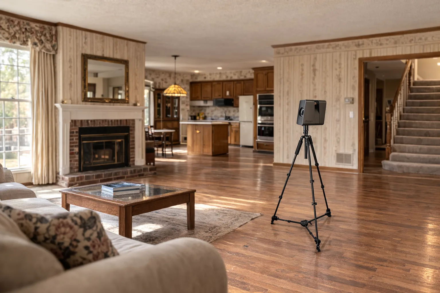
Our Matterport Pro3 scanner captures detailed spatial data that our drafting team turns into construction-ready deliverables. This isn't auto-generated CAD — every floor plan and drawing is professionally modeled from the scan data.
Typical Grand Rapids use cases
- Downtown renovation and tenant improvement projects
- Residential remodeling and addition planning
- Existing-condition documentation for commercial fit-outs
- Insurance, restoration, and damage documentation scopes
Related pages
Serving Grand Rapids neighborhoods and districts
From historic Heritage Hill renovations to modern Eastown condos, each Grand Rapids neighborhood presents unique building challenges. East Hills Victorian homes often need precise documentation for restoration work, while downtown commercial spaces require accurate as-builts for tenant improvements and adaptive reuse projects.
The Wealthy Street corridor sees frequent commercial renovations where existing conditions matter for permit approval and contractor bidding. Midtown industrial conversions depend on reliable measurements before design teams can propose new layouts. West Side residential projects often involve additions and whole-house remodels where accurate existing floor plans prevent costly surprises during construction.
Our local presence means we understand these project types and can coordinate around Grand Rapids permitting schedules, contractor timelines, and seasonal construction patterns. Whether you're working on a downtown loft conversion or a residential addition in East Grand Rapids, the documentation process stays consistent.
Why Grand Rapids contractors choose LiDAR scanning
Construction teams across Grand Rapids are moving away from tape-measure field surveys toward LiDAR documentation for several practical reasons. First, accuracy matters when estimating materials and labor. A scan captures every wall angle, ceiling height variation, and structural detail that could affect scope and pricing.
Second, scheduling efficiency improves project flow. Instead of multiple measuring trips that interrupt other trades, LiDAR captures everything in one visit. The building data gets processed into deliverables while other project phases continue, keeping timelines on track.
Third, documentation quality reduces change orders and conflicts. When design teams work from accurate as-builts, fewer surprises emerge during construction. Contractors can bid more confidently, and owners get more predictable project outcomes.
For Grand Rapids renovation work, these advantages compound across project types — from Heritage Hill historic preservation to downtown commercial build-outs where precision and speed both matter.
Service area coverage
GRAB LiDAR serves Grand Rapids and surrounding communities with consistent scanning quality and turnaround times. Our primary service area includes:
- Grand Rapids
- East Grand Rapids
- Kentwood
- Wyoming
- Walker
- Grandville
- Cascade
- Ada
- Rockford
Projects throughout West Michigan are also welcome with adjusted scheduling and travel considerations. Contact us to discuss scope and logistics for sites outside the primary service area.
Frequently Asked Questions
How much does LiDAR scanning cost in Grand Rapids?
Pricing depends on building size, complexity, and deliverable requirements. Most residential projects range from $800-2,500, while commercial spaces vary based on square footage and access requirements. We provide detailed quotes after reviewing project scope and site conditions.
How long does a building scan take?
Most buildings take 1–2 hours on site. Larger commercial spaces may take longer depending on layout and access. The scanning process is non-disruptive and buildings usually remain occupied during data capture.
What file formats do you deliver?
Standard deliverables include PDF floor plans, Autodesk AutoCAD DWG files, and SketchUp SKP models. We can also provide Autodesk Revit RVT files, point cloud data, or custom formats based on your workflow requirements. All plans are created by experienced drafters, not auto-generated.
Do you scan occupied buildings?
Yes, LiDAR scanning works well in occupied residential and commercial spaces. The process is quiet and non-invasive, though we coordinate timing with building occupants to minimize disruption during data capture.
How accurate is LiDAR scanning?
Our Matterport Pro3 captures detailed spatial data. Our team models that into floor plans that meet construction documentation standards for renovation and design work.