As-Built Floor Plans
Dimensioned plans from LiDAR scan data in PDF, AutoCAD, Revit, or SketchUp.
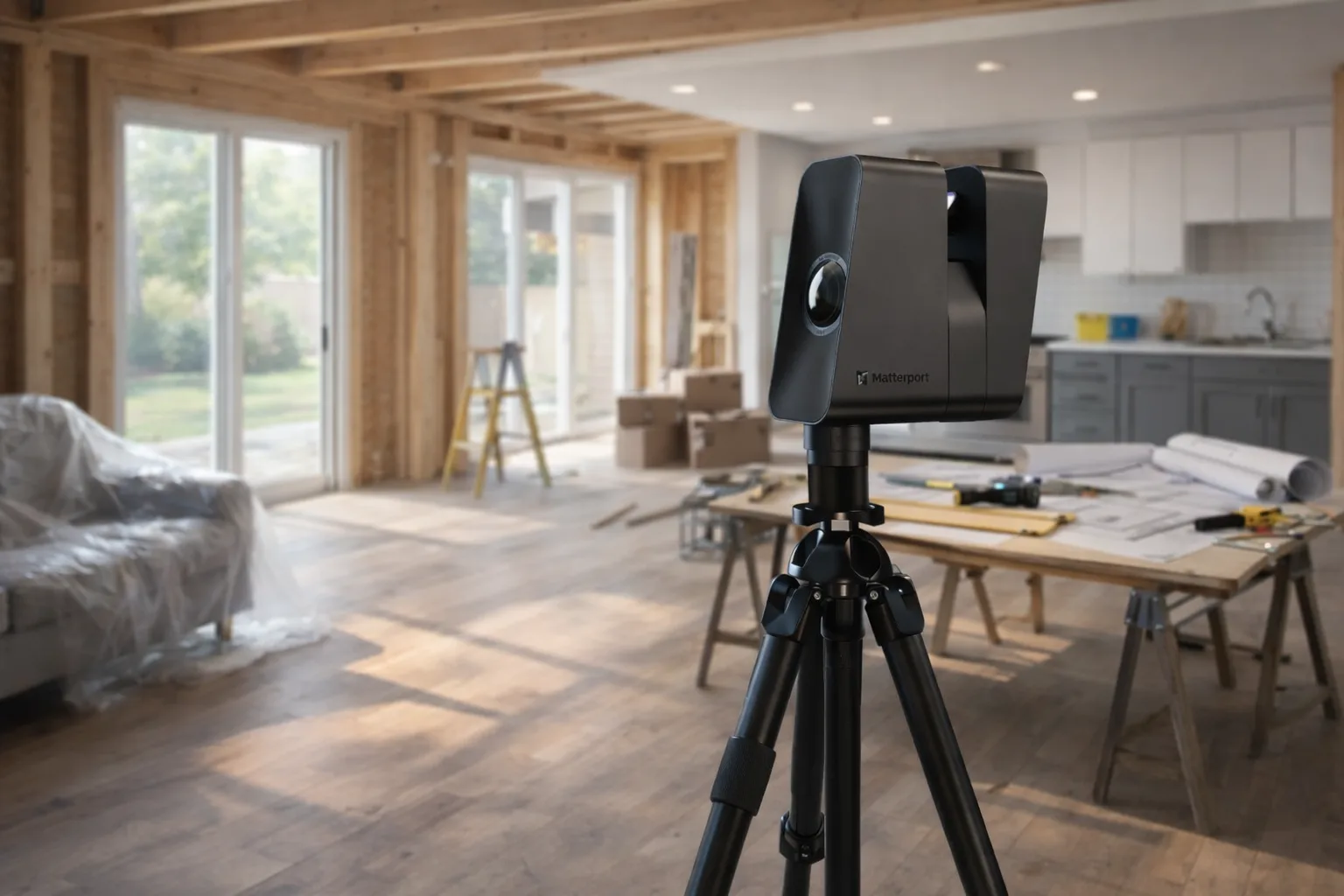
View service detailsAccurate existing conditions before TI design begins. LiDAR scanning captures the actual space in 1–2 hours — so architects design from real dimensions, contractors bid without guesswork, and change orders stay off the schedule.
Every tenant improvement project starts with the existing space. Before an architect can design a new layout — or a contractor can price the demo and rough-in — someone needs to document what's there. Partition locations. Structural columns. Ceiling grid height. MEP stub-ins. Opening dimensions. That's existing conditions documentation, and for commercial TI work, it needs to be accurate.
The traditional approach is to send someone with a tape measure and a sketch pad. For a 5,000 square foot commercial suite, that can take most of a day, and the resulting drawings still carry measurement uncertainty. If a wall location is off by four inches or a ceiling height is estimated, that uncertainty propagates through every design and bidding decision downstream.
GRAB uses LiDAR scanning to capture the full space in a single site visit — typically 1–2 hours for most commercial suites. The scan captures wall geometry, structural elements, ceiling conditions, and openings as they actually exist. Our drafting team converts that data into professionally drafted floor plans within 1–2 days.
Commercial tenant improvement permits require floor plans that show existing and proposed conditions. When the existing conditions drawings are inaccurate, permit reviewers catch discrepancies between the drawings and what was actually built. That creates back-and-forth with the building department, revised drawings, and permit delays before the job even starts.
Accurate LiDAR-based existing conditions drawings reduce that risk. The floor plans reflect what's actually in the space, not an approximation. When the permit set is built on a solid foundation, review cycles are shorter and fewer revisions are needed.
For design-build teams and commercial GCs handling their own TI permitting, this is the most direct way to reduce permit timeline risk — get the existing conditions right before design begins, not after the first plan check.
A typical commercial TI project timeline looks like this: lease signed, design begins, permit submitted, work starts. The existing conditions documentation happens at the beginning of design. If it's slow or inaccurate, the delay compounds through every subsequent phase.
LiDAR scanning compresses the existing conditions phase. Instead of multiple field measuring trips, sketch reviews, and drafting iterations, the process is one site visit and delivery within 1–2 days. The design team starts with accurate base drawings immediately, and the project timeline doesn't lose days or weeks to an inefficient measurement process.
For property managers coordinating multiple TI projects across a portfolio, consistent scanning documentation also means the existing conditions package for each suite is produced the same way — same format, same accuracy, same turnaround. That consistency makes it easier to coordinate between the property team, the tenant's architect, and the contractor.
Tenant improvement projects require accurate existing conditions before design work begins. Without them, architects design against estimated dimensions, contractors bid with uncertainty, and change orders appear when field conditions don't match the drawings. LiDAR captures the actual space in 1–2 hours and delivers floor plans within 1–2 days.
A TI as-built documents the existing conditions of a commercial space before tenant improvement design begins — wall locations, ceiling heights, structural columns, MEP rough-in locations, and opening dimensions. This is the base document the design team works from.
LiDAR captures the full geometry of a commercial space in a single site visit. From that scan data, we produce accurate dimensioned floor plans showing the actual leasable space — useful for lease negotiations, space planning, and TI design. Plans delivered in Autodesk AutoCAD, Autodesk Revit, SketchUp, or PDF.
Yes, with some coordination. LiDAR scanning works best in clear conditions, but we can work around furniture, fixtures, and occupied areas during off-hours or low-traffic periods. We discuss access requirements during the quoting process.
Dimensioned plans from LiDAR scan data in PDF, AutoCAD, Revit, or SketchUp.
View service detailsComplete existing conditions packages for permit sets and contractor coordination.
View service detailsPortfolio-level documentation for buildings with ongoing TI activity.
View industry details